Welcome to the Birmingham Air Traffic Control VFR website. Here you will find some useful information regarding Birmingham’s airspace.
Birmingham Airport is located 5.5 NM (10.2 km; 6.3 mi) East-Southeast of Birmingham city Centre, at Bickenhill in the Metropolitan Borough of Solihull within the West Midlands, England.
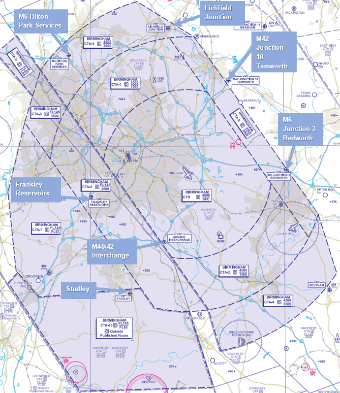
Birmingham aerodrome is surrounded by Class D airspace so it is important that pilots familiarise themselves with our airspace to help reduce the risk of an airspace infringement.
There are a large number of infringements in and around Birmingham Airport’s Airspace. The attached VRP photographs (courtesy of Mike Roberts, Managing Director of Take Flight Aviation) will be helpful for pilots.
Birmingham Airport Information
ICAO/IATA: EGBB/BHX
Elevation: 339ft
Runway: 15/33
Radar Frequency: 123.980
Tower Frequency: 118.305
Listening Squawk: 0010
ATIS: 136.030
ATIS Phone: 0121 767 1260
The CAA Airspace and Safety Initiative team have produced a Frequency Monitoring Code area guide for Birmingham.
Temporary Change to CAT D VM(C)A(H)
From 27th June 2024, the CAT D VM(C)A(H) will be increased from 1310ft to 1410ft due to crane activity in Birmingham city centre. Please see EGBB’s AIP for related charts.
Moreton-in-Marsh RA(T)
A UAS trials exercise will be conducted at the Fire Service College in Moreton-in-Marsh, Gloucestershire between 8th and 10th October 2024. Restriction of Flying Regulations will be implemented for the trials as a result. Please refer to AIC M 143/2024 for further information using the link below.
Latest CAA News
